WHO WE ARE
FULLY LICENSED AND INSURED DRONE SERVICES, 3D LASER SCANNING & DATA ANALYSIS FOR REMOTE AUSTRALIA
Pty Ltd is the leading drone-based aerial imagery provider in the Northern Territory and North-West Queensland. On our journey, we created our award-winning business to provide a specialised service for the remote regions of Central Australia and the Top End to find innovative solutions for high-value aerial surveys and asset inspections.
Combined with the latest technology our datasets are following the latest standards in high quality aerial survey and inspections - time and time again, with a unique skill set of understanding remote context with innovative solutions: one dataset - multiple outcomes.
Our laser and drone technology has been tested to withstand the tough Australian conditions to provide a high-quality, fast image processing, accurate and actionable data access. The outcomes provide an indispensable communication tool, ideal for using throughout the planning and approving of new projects, regulatory requirements, monitor development and time series data analysis.
has been partnering with PAW Media, an Aboriginal Corporation in Yuendumu, to help address local critical business issues with industry leading solutions in the field of 3D visualisation.
We understand that projects in remote Australia are challenging - come and see us to find a solution that works for you.
Taking Remote Australia Beyond - with .
SERVICES

AERIAL SURVEYING & MAPPING
LiDAR and Photogrammetry
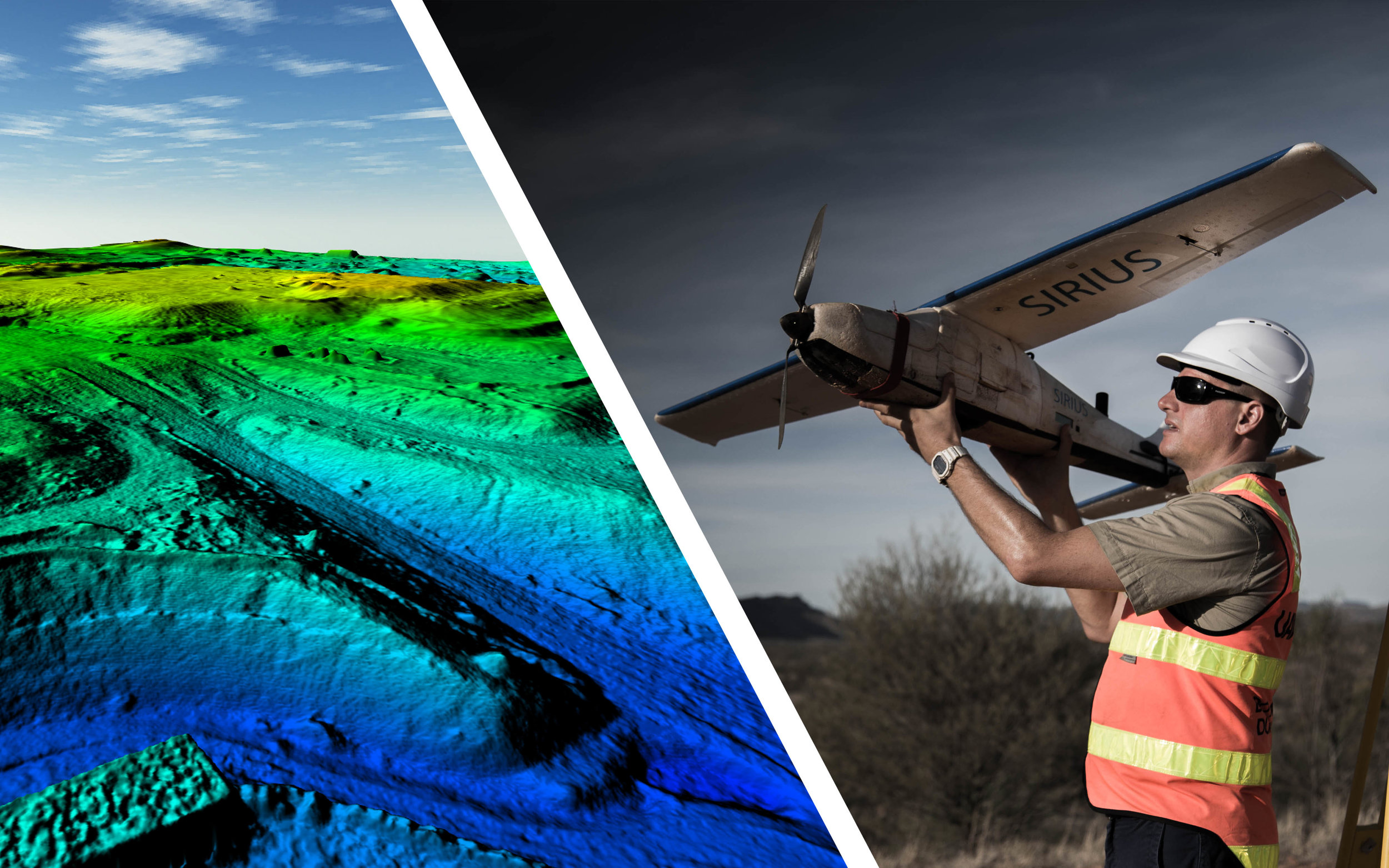
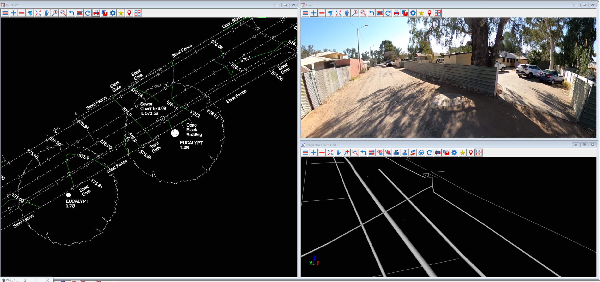
Drone technology has reshaped the geo-spatial information sphere. What used to be a day and sometimes a week's work can now be retrieved within hours or less. And with modern day processing algorithms, is able to process additional layers of information from one photogrammetry dataset, such as terrain models, surface or elevation models, classification of areas and objects, point clouds etc. The datasets of high-value areas, such as communities, mine sites, pipelines or government assets, comply with all common GIS software standards. Additionally we are offering our datasets on a cloud-based visualisation platform, with mapping tools and interactive sharing, without the need to install additional software: a valuable asset to have for all project managers, asset managers, infrastructure and town planning, geo-spatial engineers, surveyors, civil engineers and other land-related service providers - fast turn-around, efficient distribution, cost effective.
All our high-end equipment works at survey accuracy through RTK and PPK, with no further need to apply ground control points to ensure accurate, yet smooth, uninterrupted workflow even on a busy day.

TERRESTRIAL SURVEYING
Above and Underground Services
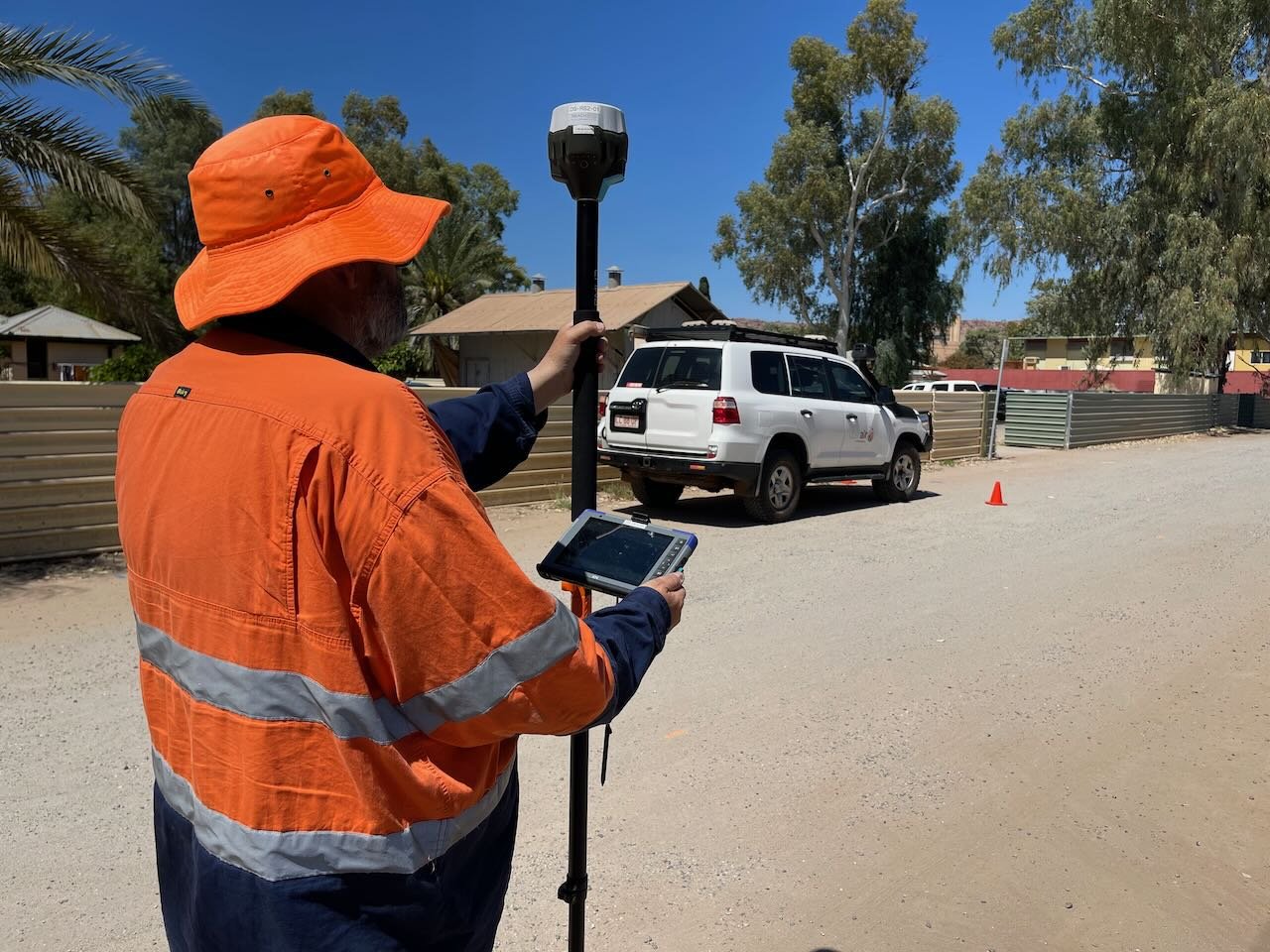
Safety first - the days are counted of expensive assessments of hard-to-reach or even hazardous areas of assets or landscape with the availability of 3D asset inspections by . The solution is cost-effective and reduces project timelines significantly: Our equipment provides geo-referenced visualisation to assess your assets condition in 2D high-resolution photographs or accurate 3D models at the convenience of your desktop bundled with an easy-to-use platform: no need to install additional software, all you need is a computer and an internet connection.

Also available is thermal inspection with our aerial infra-red camera, opening up a whole new aspect to inspections: from insulation inspection to power line grids, our analysis data is fast and effective.
For our aerial inspection equipment fulfils the highest safety standards, with triple redundancy, magnetic interference proof, and certified radio controls - a tick in the box for efficiency in a safe work place environment.

BIM - Building Information Modelling
Reverse Engineering to streamline your project

Our business provides cutting-edge laser scanning based 3D Revit® modelling as as-builts for architects, designers, and asset managers.
Complex site structures, plant equipment, historic sites or working out the scope of a larger project, 3D visualisation can help get your project off the ground fast and more efficiently. All our datasets are fully compatible with industry standard 3D software.
Combining accurate vertical representations from lasers with aerial overviews, this is what we can provide: is your One-Stop-Shop for visualising your project.